The Unofficial Guide to the Thames Goldfield - Introduction
Richard (Dick) Wilkins
In this series of posts, I will assemble my research on the Thames Goldfields. There is no central theme and I have just picked aspects that interested me, hence the term “Vignettes”. There may well be ten, there could be more or less. Why do it? Very good question, but a few years ago I realised that there are few people left with any kind of first hand knowledge of Thames in the 1950s when it was still “semi-raw” with evidence of the mining days still visible in the town and the hills.
Our family was somewhat unique (some would say unusual) in that the Residence Site(s) occupied by my great grandfather Richard Ross from 1867 on Eureka Hill were still occupied by the Ross family until 1966 – some forty years after all other families had left for the township.
Richard Ross was an old fashioned patriarch, often called “King Dick” and behind his back some of the family referred to him as a “Prodigious Progenitor”. I cannot claim either title but I was the last descendant of the family to start their life on Eureka Hill, though very briefly, in 1944-45.
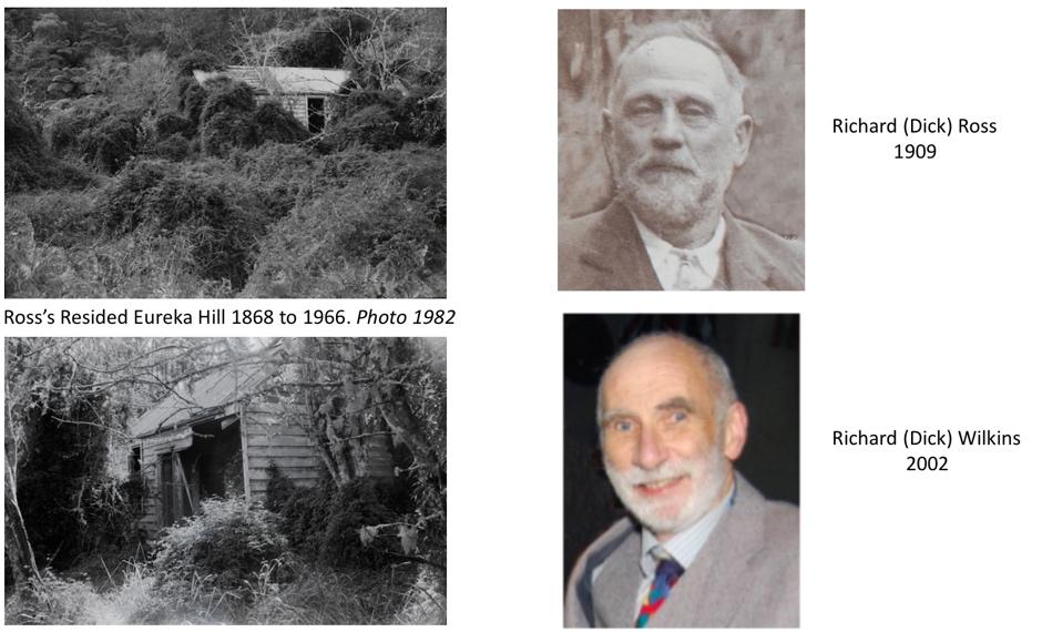
Figure 1. By 2020 (40 years after these photos), the remains of the Ross home are almost invisible.
So, that is the background; the vignettes that I plan to post over the next year or so are listed below. Actually, some have appeared elsewhere but will be republished here in updated versions.
Loosely, they will cover the following topics:
1. Analysing the first photographs of the Thames Goldfields
2. Lest we forget – the Shotover Claim
3. Tararu Creek and Water Power
4. The Moanataiari Tramway
5. Richard Ross Part 1 -The Man
6. Richard Ross Part 2 – Sailor and Miner
7. La Monte – the Wrong Man in the Right Place at the Right Time
8. Early Thames Doctors
9. Public Health in Thames
10. What happened to Residence Sites?
I will warn the reader now that these vignettes tend very much to the academic and research end of the scale and may contain too much detail for people expecting an entertaining read. With this in mind, I will also produce a You Tube series covering each vignette (details to be announced).
The rest of this introduction may not interest the casual reader, but for those of you who want to research things in depth, it may be of some help if I explain in some detail how I conducted my own research, specifically outlining the sources of my material.
A good place to start is to ferret out any family sources; if it exists, this stuff could be valuable as it may be unique to you. However, it will quickly become apparent that a much wider range of resources need to be assembled. To do the job properly one has to consult an immense range of sources, some on the internet, some in books plus archival and library resources. Briefly, the following are what I found useful.
Actual website links are not given in this introduction as any reader seriously into research will be able to easily locate them.
Books
There are around a dozen “must have” books on early Thames and mining. Some of these contain a lot of mining details, others are valuable for early photographs though, frustratingly, sources are often not given, nor locations or dates, and some photos are erroneously labelled.

Figure 2. Books on Early Thames and the Goldfield.
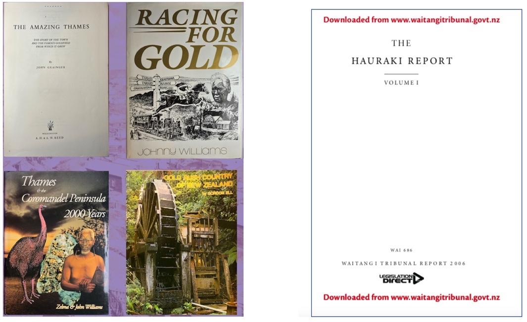
Figure 3. Yet more books and the Hauraki Report.
Some tend to be a little gung ho and romantic about early Thames, so have to be taken with a grain of salt. When it comes to interactions with Maori and Maori history, some just ignore it and others get things wrong. By far the best Maori source is the “Hauraki Report” of the Waitangi Tribunal which also has well researched information on European activities. University publications are also reliable and many of these are now online. For example, Johnson describes how challenging it was for all the population of Thames in the 1870s. Philip Hart has done an enormous amount of research published in a series of Working Papers but most focus on the Te Aroha area. Judith Walsh’s thesis gives a good summary of what is in the Hauraki Report.

Figure 4. University Research is Valuable
On Line Resources
A number of on-line resources give reliable information, including some that cannot be found elsewhere. For instance, Kae Lewis’s GoldRush online has a directory of goldminers active in early Otago and Hauraki.

Figure 5. Goldrush Online
The Genealogy and History Resources blogsite contains a wealth of information, both old and new, and the Ohinemuri Journal (in recess) has a large number of well researched and edited articles.
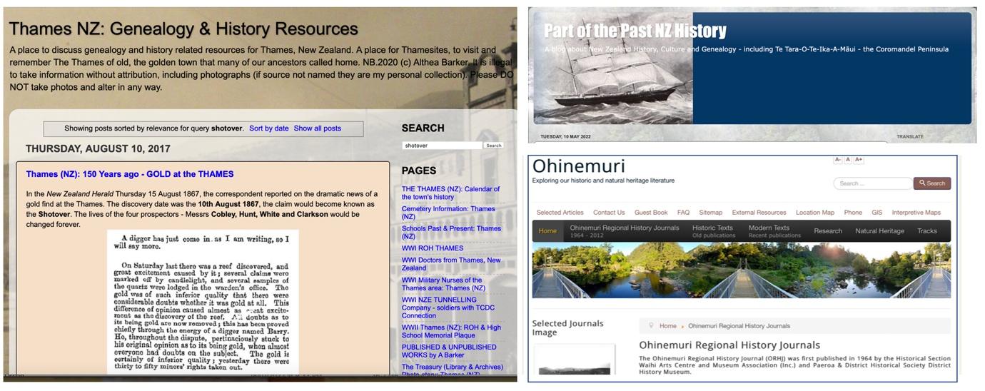
Figure 6. Other sites with valuable information.
A lot of detailed day to day information can be got by searching Newspapers in Papers Past. The search engine is quite powerful if used correctly but care has to be taken with search terms as an individual might appear with initials spaced in a variety of ways and names can be spelt with variations, e.g. Moanataiari and Moanatairi.

Figure 7. PapersPast contains newspapers up to the 1940s.
While a vast amount of information can be gleaned from PapersPast, it does tempt some writers to put together articles which are little more than assembled excerpts based on what they have returned from key word searches. While these can be a valuable source, they often do little to present in-depth discussions of the topic in hand.
Parliamentary Papers can be searched on the same site. The Mines Reports contain a lot of information on goldmining and associated matters. Also, various hospital and health reports give detailed data on public health in early Thames.
Occasionally, useful information about early Thames people can be found at Ancestry.com. For instance, while little accurate information is written on William Hunt’s life after the Shotover Claim days, quite a bit of information on his later life can be sourced there.
On the Ground Resources in Thames.
There are five principal physical resources, all dependent on volunteers (the School of Mines is a Heritage NZ site, but has now moved to focussing mainly on exhibiting). These also have websites of varying sophistication. (The Thames Library also has a range of historical material but this appears to be obscurely catalogued). The only one organisation that is attempting to create a properly archived resource is The Treasury and very large amounts of material has been deposited by local people in their purpose built Archive. Unfortunately, the proper cataloguing let alone on-line access to this material has proved a huge challenge and, as of 2022 it is just about impossible to access specific information. However, their website gives access to back articles of The Journal which contain valuable well edited information, and the True Tale series of books are also very useful.

Figure 8. Organisations in Thames that hold physical information.
Resources Available Nationally.
Undoubtedly, the most comprehensive collection of information is in Archives NZ. They have four physical locations (Dunedin, Christchurch, Wellington and Auckland). In a perfect world, all the old mining records, and most other early local government files, would have been transferred to Archives NZ. Unfortunately, for Thames, there are significant gaps in all sorts of records, partly because of poor storage (until the mid 1900s they were considered of little value), flooding (many were stored in the basement of Thames Hospital) and fire (after they were transferred to Wellington). Thus, when researching some topics, such as early miners Residence Sites, one often comes up against a brick wall. In other cases, good runs of records exist. Most of these that relate to mining are in the Auckland branch and, for example, Kae and Evan Lewis were able to photograph a large number of maps of 1868-1869 mining claims for the book “Gold Rush to the Thames.”
Unfortunately, as well as having to travel to Auckland Airport (site of the Archives Branch), getting access both to the reading room, and to records, has become much more complicated than when the Lewis’s did their research. This is unfortunate, as with a modern image stabilised cell phone cameras, very high quality copies of maps, documents and photographs can be made in seconds. For most of us, we have to fight the quaint online enquiry form, guess if the record (if there is an image) is promising, then order it through a convoluted system at $25 a pop, then wait for it to be emailed (all takes a week or more) and hope we get something useful. With care, the hit rate can be reasonable, for example, this plan of the Missouri Machine Site.
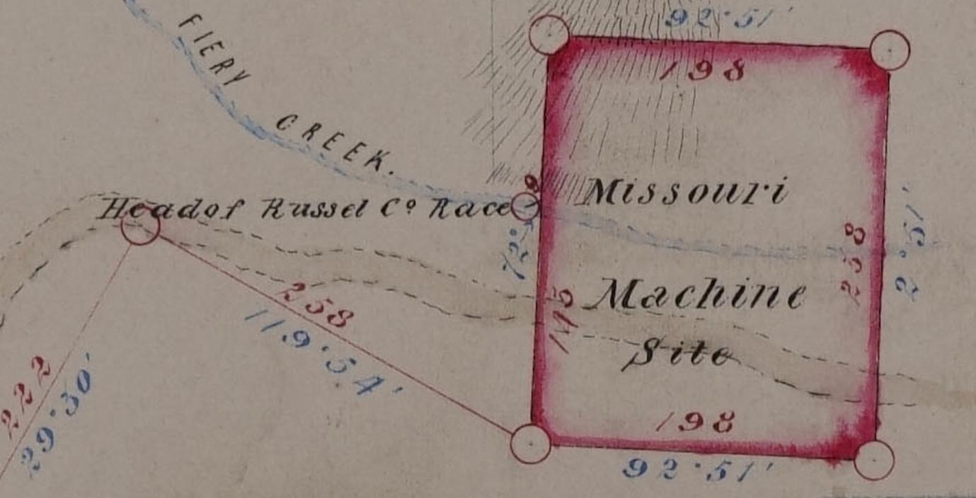
Figure 9. The type of mining plan held by Archives NZ (units are links and degrees)
Photographs
Now we come to my favourite resource. I firmly believe a photograph is worth a thousand words, and when it comes to Thames they are doubly valuable, the reason being that virtually all evidence of mining has been obliterated from the landscape or very hard to detect. This contrasts with areas such as Central Otago and the West Coast where much mining equipment was just abandoned, often in open landscapes, when gold gave out and people left.
I discuss photography in detail in the next post, but in essence, a high quality early photograph gives far more information than a written description though quite a lot of work may be required extract maximum information from it. An extremely good example is Grahams Town, taken by Daniel Mundy in early 1870 in which many early buildings can be identified.

Figure 10. Grahams Town. The iconic image produced by Daniel Mundy in 1870
Where does one source such photographs? The first port of call is DigitalNZ which catalogues virtually all photographs that have been put online by institutions (Museums, Libraries, Archives, etc) throughout New Zealand. Often a high resolution copy is directly available free of charge but in other cases, they may have to be ordered, usually at a cost of about $25. Auckland Libraries has a particularly good collection of Thames photographs and the staff are helpful. The National Library of NZ (Alexander Turnbull) have very large collections but are somewhat less responsive. Occasionally items related to Thames turn up in provincial collections (e.g. Nelson Libraries) but these are often not identified as Thames and one has to screen through their collections using generic terms such as “Gold” “Mining” or “Tramway”. Another problem with all collections are photographs labelled as “unidentified”. Related to this, occasionally a photograph will be mis-identified.
Books, such as those in Figures 2 & 3 are another valuable source of photographs. Usually, these are of low quality, often half tone, and in older books it is extremely rare for sources to be given. Sometimes it is possible to identify and obtain a high quality copy from a library but that is often not the case. Thus the Thames Souvenir Jubilee book (1927) contains many photographs (with persons identified) that were probably in newspaper archives (principally the Thames Star) and have long ago been dumped. Some unsourced photographs that are difficult to trace probably were obtained by authors who were on personal terms with families that have old photo albums and postcards (often these are of high quality). A peculiar problem, which illustrates how times have changed, is that writers such as Johnny Williams and Gordon Ell were given free access to archives (Alexander Turnbull and the Auckland Institute) back in the late 1990s. Johnny was apparently allowed to copy any photographs that he wished, and although he sometimes gives a source as “Alexander Turnbull Library” it may not appear in their on line catalogue and it can take much cajoling to get the staff to locate it. Auckland Museum (formerly The Auckland Institute) is even more of a black box and simply could not find any information on photographs that Gordon Ell had copied.
Basic Research
When it comes to ascertaining where things were “on the ground”, one has to employ a number of resources, old photographs, old maps, Google Earth, field studies and GPS. Plans such as in Figure 9 and Claim Maps are invaluable. As stated above, one problem is finding out what is available and then purchasing copies at $25 each. I discovered that each “survey” has to be critically examined as there are sometimes mistakes or ambiguities, often with respect to true versus magnetic north (in the latter case not forgetting to allow for the several degrees increase in declination from 1867 to 2022). Also, where early surveying grids are employed, they use the “Mt Eden Circuit” and calculations based on this can deviate significantly given the 3500 odd chains to Thames. Survey measurements referenced to local landmarks are usually accurate, but two early trig stations (Messenger, Punga Flat) no longer exist and one has to use other reference points, e.g. major mine shaft locations. (Some authors also make the mistake of confusing the surveyors unit of length, the “Link” with “Feet”.)
The errors on supposedly surveyed plans can be substantial. Thus the Plan of the Shotover Gold Mining Lease in 1869, though it gives accurate dimensions of the actual claim (See Post on the Shotover Claim), includes a wildly inaccurate coastline, possibly due to cobbling together two maps with different “Norths”. Pulman’s early maps give a more accurate overall view.

Figure 11. Portion of Pulman map of Thames (~1870)
Some of the early maps, although valuable in general outline, are little more than sketches. Thus in the post on the Moanataiari Tramway, use was made of several early maps, but none were definitive (the original tramway plans were apparently deposited in Thames but have disappeared). Considerable work was required to pinpoint the locations of the stations on the tramway. The clue was that most were put at convenient points for loading from major claims (or near batteries); fortunately, the one that was not could be pinpointed by reference to Daniel Mundy’s photographs. As much as possible, these were cross checked by field trips and GPS readings and the use of Google Earth Pro.
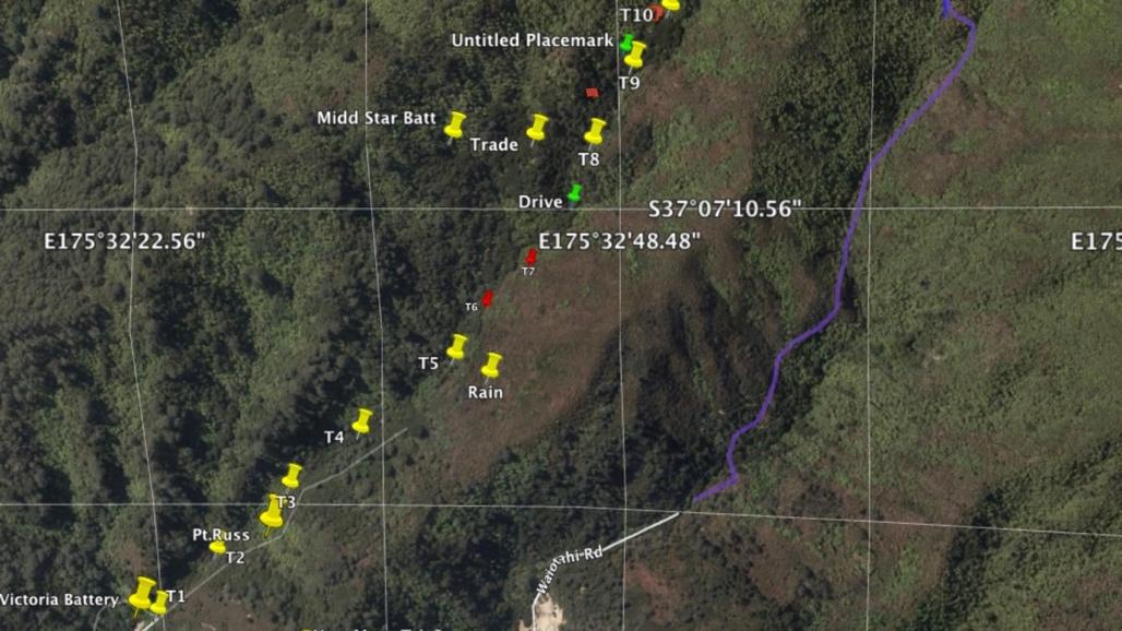
Figure 12. Placemarks of Moanataiari tramway stations on Google Earth Pro.
In this and other work, the comprehensive 1990 survey of mining relics in the Thames region by Ritchie proved invaluable, the only problem being that in those pre-GPS days some of the topo map references are, understandably, in error, especially in areas with dense bush and no local landmarks.

Figure 13. Ritchie surveyed many mining sites in Thames (some information is summarised in the book “Coromandel Gold”)
The Ritchie survey is somewhat hard to trace as it is now on the Heritage NZ website at:
https://dl.heritage.org.nz/greenstone3/library/sites/heritage-nz/collect/pdf-reports/index/assoc/Ritchie2/7.dir/Ritchie27.pdf;jsessionid=C8450D6D075817F02EC94673AF913F09
Google earth, satellite maps and aerial maps (from 1944) were very useful for pinpointing local features (much evidence of mining was still visible in 1944 aerials) but there are limitations. For instance, the generation of contours is difficult on Google Earth, though the Thames Coromandel District Council Smart Maps do have an option for generating approximate 5m contours. An associated limitation is that Google Earth (and satellite mapping) does not give accurate altitudes in some areas of rugged terrain and the errors can be substantial. LIDAR (Light Detection and Ranging) is much more accurate (~1m) but as of 2022 is only available from LINZ for Thames township and the immediate vicinity.
Acknowledgements.
The advice of Dr Keith Giles, Principal Photographs Librarian at Auckland Libraries has been invaluable in both sourcing and critiquing early Thames photographs.
Dave Wilton, with his vast knowledge of Thames, has kept me straight on all things archaeological.


Comments
Post a Comment